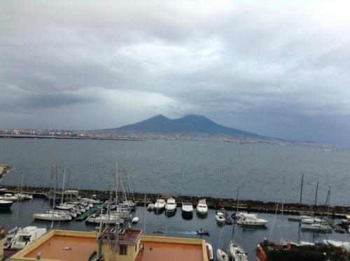
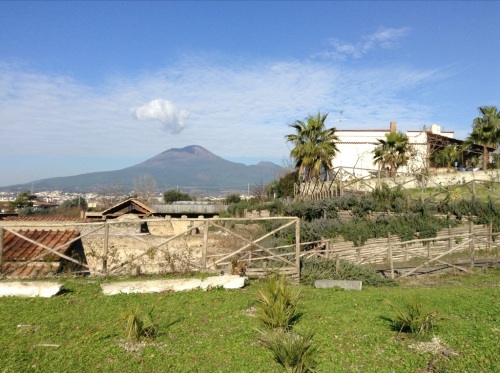
Today is absolutely gorgeous, so I wandered up to take advantage of the crystal clear skies & great views. Where am I?
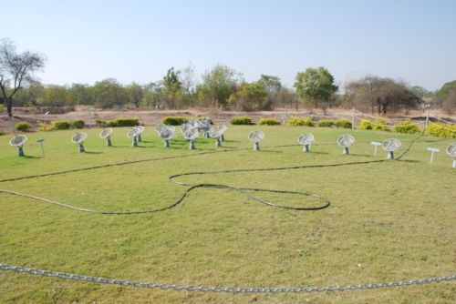
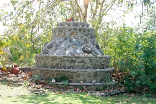
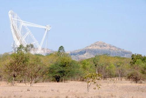
I’ll keep with the India theme from last week and choose a few more pictures from the Giant Metre Radio Telescope (GMRT), which I visited last March as part of a whirlwind trip to Bangalore and Pune. The telescope is located on the Deccan Plateau with the central cluster of antenna on some really lovely property owned by National Centre for Astrophysics (NCRA) and then branching out with a a few antenna up to 25 km away (map of the array). At the center of the array, they have a heavily watered garden that includes a model of the distribution of the antenna:
We drove around the property a bit (all dirt roads), but didn’t have time to go and visit the antennas further out. We did go into the central antenna, which was nicely air conditioned to make sure the electronics worked. (March in India means that air conditioning is pretty welcome even if you do have to share it with servers.)
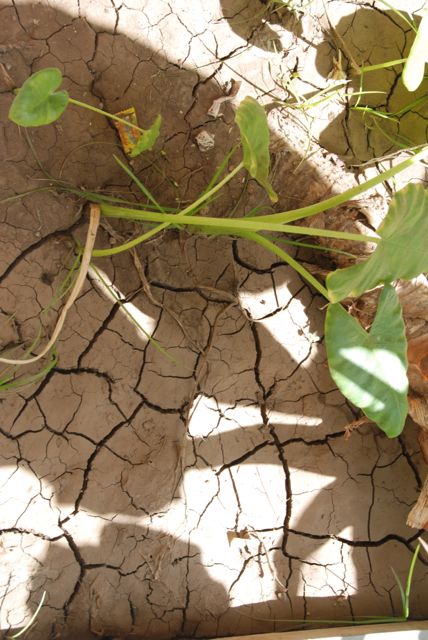
Because I was with astrophysicists and engineers, I didn’t have the chance to go and visit the local outcrops of the flood basalt up close and personal, so most of my pictures are of flowers:
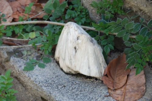
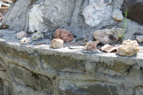
I do have a few “geology” related pictures:

Inner courtyard at the research facility at GMRT. I don’t know whether the hexagon paving tiles were a nod to the local geology or not, but I thought they were a cool link to the flood basalts.
I’ve got some more “buildings constructed using cool basalt” pictures from Pune that I’ll share next week 🙂
Posted in Uncategorized | Tagged geology, travel | Leave a Comment »
Its time to move on from the Italian rocks, but instead of reaching for recent blizzard pictures, I went for a different trip. I dug out the following picture while working on my lecture notes for igneous rocks because of a student question about the rocks in this area.
Based on the randomness of where I took this picture, anyone who manages to name 1) what the picture is of and 2) where I took the picture from, I’ll send you your choice of type of Girl Scout cookies.
Posted in Uncategorized | Tagged geology, travel | 7 Comments »
I’m going to finish off the month with one more picture from my recent Italian sojourn.
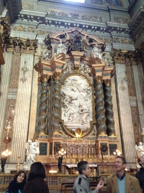
One thing I was highly impressed by in Italy with was the huge diversity of rock types used for statues, busts, church altars, flooring material, and building siding. I’ve got pictures on pictures that I took not really of the artwork, but of what it was made out of or what it was sitting on — unfortunately, with the semester starting so quickly after my trip, the majority are still on my D80. Hopefully when things calm down, I’ll be able to show them off a bit. But for now, this is an altar at the Chiesa del Gesu di Roma — note the diversity of rock types just in this one area of the church:
Posted in Uncategorized | Tagged geology, travel | Leave a Comment »
Ryan at Glacial Till is hosting this month’s Accretionary Wedge: Geo-Brews and Geo-Cocktails. I have two “additions” to the list.
The first came from a spin through the NH state liquor store a number of years ago where I found a bottle of Reyka vodka on sale. The front of the bottle claimed that it was “lava rock filtered” and that was enough for me to plunk down a few dollars to bring home. One of the students I had in my Iceland geology class two years ago actually chose to research the company and learn more about how they used not only basalt rocks to filter the vodka, but also used geothermal energy to run their distillery. And the vodka wasn’t half bad either 🙂 The bottle is still sitting on my bookcase (empty unfortunately).
(Revised 1. February with bottle picture)
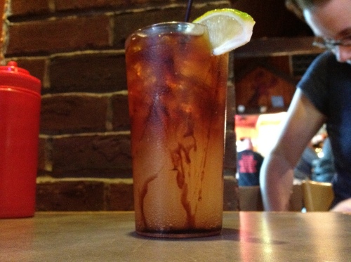
The second came from a small shack in downtown Salem, MA last summer. Because of a request from my mom, we ended up in this little hole in the wall in Salem having dinner. While dinner itself wasn’t anything to return for, my evening libation was called a “Great Molasses Flood” and included rum, ginger beer, and molasses. When I teach about viscosity, I end up discussing with my students the “Boston Molasses Flood” which occurred in January 15, 1919 in the North End of Boston. Due to a faulty tank, mixing warm & cold molasses, and drastic changes in temperature that January, a flood of about 2 million gallons of molasses killed 21 and injured 150. This drink was a perfect example of how cold molasses (when they first served it) has a high viscosity, but as the drink warmed up, the molasses became less viscous and started to mix with the rum & ginger beer. It was good, too 🙂 The picture below was taken just after it landed on the table, so the molasses was still cold and can be seen streaking down the inside of the glass:
Posted in Uncategorized | Tagged AW, geology | 3 Comments »
I’m a bit late, so we’ll just go with another view of Vesuvius. This time the view is from Castel dell’Ovo (Castle of the Egg):
Posted in Uncategorized | Tagged geology, travel | Leave a Comment »
There has been an amazing number of scientists from a wide range of fields posting what they do using the “Up-Goer Five Text Editor.” The editor only allows you to use the thousand most common English words to try and describe anything. The concept was inspired by the create comic XKCD, which attempted to describe how a Saturn Five rocket worked using the same constrictions.
Anne & Chris have assembled a wide variety of these attempts at Ten Hundred Words of Science. I’m a bit late to the carnival, but my first attempt during breaks from teaching yesterday seems to have magically disappeared from my computer. Oh well, here’s attempt number two:
I help students learn how to study all types of rocks. The rocks tell us story about how the world works. We study rocks close to us, in far places, and in space. We also study how water, ice, humans, trees, and animals change the rocks. Most of my students will only take one class about rocks, so I try to give them understanding of how the world works for every day things.
While my students study all rocks, my own interest is in rocks that were made warmer or pressed deep under the ground. What is in rocks will change if they are cold or warm or hot and whether they were pressed a little or a lot. Time is also important for how the rocks will change. Looking at the new rocks can help tell the story of how one place changed over time.
Posted in Uncategorized | Tagged geology, writing | 1 Comment »
I’m back in MA for the first week of the spring semester, so this week’s picture is from the warmer clime I just left. Points for both volcanoes names plus where I must have been to take the picture — warning, the latter is slightly tricky!
Posted in Uncategorized | Tagged geology, travel | 2 Comments »
I have lab on Tuesday & Thursday this semester (same lab, just half the physical students have lab on Tues & the other 1/2 on Thurs). As I was putting out lab & taking pictures of the samples for my own documentation, I contemplated the fact that of the 13 labs I have scheduled for this semester, I only designed one from the ground up. Let me give you the chart & where they were originally from:
| Lab 1 | Rock Stories | Gustavus lab manual | Lab 2 | Scientific method | Kim Hannula | Lab 3 | Minerals I | Gustavus lab manual | Lab 4 | Minerals II | Gustavus lab manual | Lab 5 | Rocks I | Gustavus lab manual | Lab 6 | Rocks II | Gustavus lab manual | Lab 7 | Forest River Park | Rory McFadden | Lab 8 | Topographic maps | Gustavus lab manual | Lab 9 | locating epicenters | Virtual Earthquake | Lab 10 | Structural geology | Me! | Lab 11 | Fossils | still looking for a good one to use… | Lab 12 | Groundwater | currently use one found on internet, but we just got “ant farms” that I want to try and use | Lab 13 | Stream table | also something I want to add this semester cause we have the resources… |
As you can see, I lean strong on the Gustavus material for the rocks & minerals labs, but that department-created lab manual then goes off and focuses on a three-week sequence that involves field trips & drawing a cross-section of the St. Peter, MN area. I can do one week of field trip at Salem State, but only because we can walk to Forest River Park. That field trip is not going to result in being able to determine the geology of the entire Salem quadrangle, so I needed to go another direction.
(The rocks & mineral labs have tweaks due to the fact that I have a different set of samples available, but on the whole, the lab looks amazingly like what I taught while in MN.)
Kim Hannula replied to a tweet that I posted about a year ago & was kind enough to send me her Scientific Process lab. I modified it a bit (had to choose new buildings to measure the distance between) and changed the order of the questions after a few mutterings from the students, but it would be easily recognizable to Kim.
For the topographic map lab, the basis is the Gustavus lab, but I modified it heavily to have the students looking at local maps of Salem and eastern Massachusetts. Still, the bare bones are there if you hold them next to each other.
Unsurprisingly, I got the Forest River Park lab from another professor at Salem State. He had previously received (& modified it) from a different professor. I added a few of my own “twists” to the lab, but it is fairly close to what Rory runs in his physical class.
Though I use the data & maps from the online Virtual Earthquake site, I do print the seismographs out and have the students do the entire process by hand. Its just fun to see the students trying to remember how to use a compass to draw a circle.
Two semesters ago, I used a lab manual for the structure lab. It was the students’ least favorite lab, so I vowed to revise. This past semester, I came up with an entirely online lab where the students use Visual Geology to answer a sequence of questions and then create their own 3D blocks for the final step. The students enjoyed the lab, though I think I need to modify the questions a bit to get more educational benefit from the assignment…
My office-mate is a paleontologist and has an intro fossil lab that I may try and use this year, but I’m open to suggestions. I started lab a week earlier this semester, so this is a new one on the schedule, but students have asked for fossils in the class.
We have equipment to for a more hands-on Groundwater and Stream lab, so my goal is to develop at least one of the two this spring. Or find someone else who has already done the work and tweak. Suggestions anyone? (the groundwater models are new, but the stream table is ancient and definitely not an Emriver model)
As I look at this list, I realize how blessed I have been to be able to take a bit from here and a bit from there for my physical labs. In contrast, when I think of my mineralogy, petrology & structure labs, they are to a large part either slightly modified from what I had or taught as a grad student. There are a few additions from the SERC workshops I’ve attended, but its not nearly the hodgepodge that physical has become.
So, let me ask anyone else out there who teaches intro geology: what do you use for labs? A hodgepodge? A published lab manual? All labs you created yourself?
(Note: this is a bit self-serving, since I’m still trying to find a few more labs to use!)
Posted in Uncategorized | Tagged geology, intro, teaching | 1 Comment »
I just got back from Naples & Rome, so today’s picture is another taken on the trip:
Taken at Pompeii just outside the town’s walls. Not the difference in elevation between the current farm & the one abandoned after the 79 AD eruption of Vesuvius.
Posted in Uncategorized | Tagged geology, travel | 1 Comment »


